 Photo: Pexels
Introduction
Fukui rarely makes it onto a first trip to Japan. Most travelers spend their days moving between Tokyo, Kyoto, and Osaka, and by the time anyone considers a detour further along the Sea of Japan coast, the itinerary is usually already full. Which is a shame, because this prefecture holds two of the more distinctive natural sights in the country: a group of lakes that shift color depending on where the light hits them, and a wall of dark cliffs the ocean has been cutting into for thousands of years.
This guide covers two Japan sightseeing spots in Fukui, Mikata Five Lakes and Tojinbo, with a first-time visitor mindset, without folding in a long list of other Fukui attractions you’d likely have to skip anyway. One thing to know before you plan: the two areas sit on opposite sides of the prefecture, in different directions from central Fukui. Treat them as separate excursions rather than one loop, and this guide will walk through what each place actually involves, how to reach it, and how to decide which one fits your schedule.
Overview
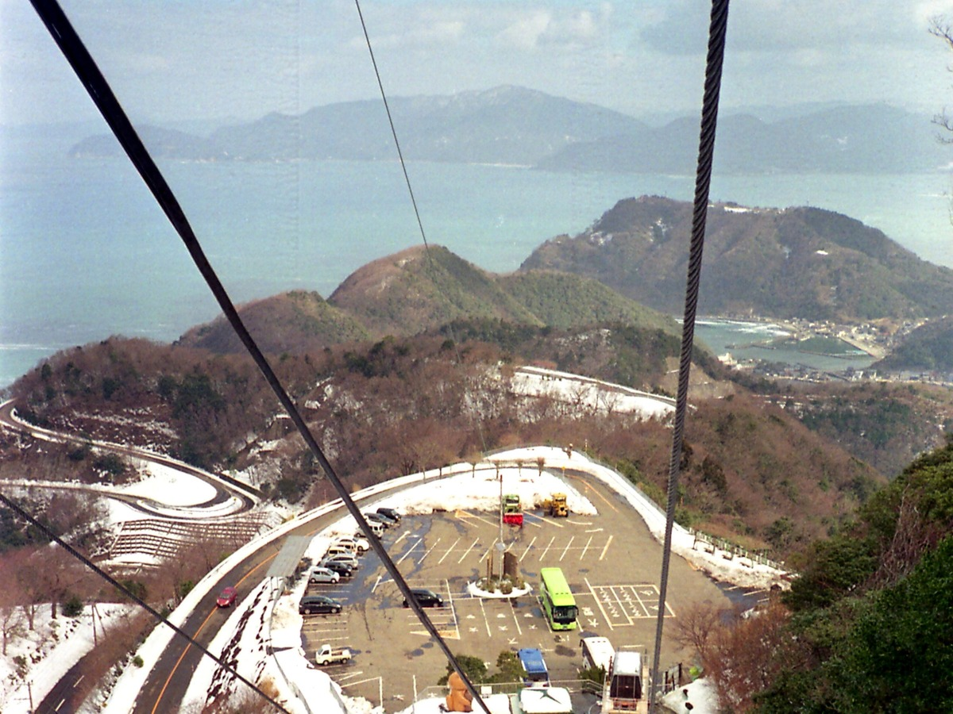
Photo: Pexels
Fukui Prefecture lies along the Sea of Japan coast in the Hokuriku region, between Kyoto and Ishikawa. It sees a fraction of the foreign visitors that Kyoto or Osaka do, which is part of why it rarely comes up in first time planning, not because there’s little to see, but because visiting takes a deliberate decision rather than following the crowd.
Mikata Five Lakes sits inland in the southern half of the prefecture, a cluster of five connected lakes inside Wakasa Bay Quasi National Park and recognized as a Ramsar wetland. Tojinbo lies on the coast further north, a stretch of columnar rock cliffs facing the open sea. One is about color and still water; the other is about scale and exposure to the weather. They work better as separate excursions than as a rushed same day pair. Mikata Five Lakes can fill most of a day, while Tojinbo works well as a shorter outing.
Mikata Five Lakes
The Mikata Five Lakes area, comprising Mikatako, Suigetsuko, Sugako, Kugushiko, and Hirugako, spans the towns of Mihama and Wakasa within Wakasa Bay Quasi National Park. Each lake has a different depth and a different mix of fresh and salt water, and from certain angles they really do look like five separate shades of blue laid side by side. Locally, they’re sometimes called the five colored lakes for exactly that reason. The wetland was registered under the Ramsar Convention in 2005, recognizing the diverse aquatic ecosystems here, including rare native fish species and waterbirds.
The clearest way to take them all in at once is from the Rainbow Line Summit Park, on top of Mt. Baijodake. The scenic road up, which was a toll route until Fukui Prefecture made it free to drive in 2022, climbs through the hills between the lakes, passing viewpoints along the way before ending at a parking area where a lift or a cable car covers the final stretch. From the terraces at the top, all five lakes are visible together, with Wakasa Bay and the Sea of Japan spreading out behind them. It is one of the few spots in the area where the whole picture comes together in a single view. Several terraces sit at slightly different angles, so it’s better to walk the full loop than stop at the first one you reach.
One access detail matters here specifically: the summit park itself can’t be reached on foot or by bicycle. On the days it operates, a seasonal sightseeing bus, the Gokoichi Bus, connects nearby stations to the summit park; outside those days, a taxi or a rental car covers the final stretch from the nearest station instead. Since the bus runs on a limited, seasonal schedule, check the official website for current operating days before counting on it. That only applies to the summit park itself, not to the wider Mikata Five Lakes area; the lake level sights below are easier to reach independently. The park charges for admission, which includes the lift or cable car ride. Opening hours vary by season; check the official website for current admission details.
Down at lake level, the experience opens up. Boat cruises run across parts of the lake system, and a cycling route follows the water’s edge for travelers who’d rather move at their own pace. The route is flat and well marked, and it is manageable in a few hours without major hills. It passes farmland and small settlements between the lakes rather than staying purely scenic the whole way. Kayaking and paddleboarding are also available through local operators for anyone who wants to get closer to the water rather than looking down at it from above.
Right by the lakeshore, the Fukui Prefectural Varve Museum gives the area a second reason to slow down. Lake Suigetsu’s floor holds an unbroken 70,000year record of sediment, laid down one thin layer at a time. Geologists call this phenomenon a varve, and the museum displays an actual 45meter core of it as a stained glass installation. That same sediment record serves internationally as a reference standard for dating archaeological and geological samples found elsewhere in the world, which makes this one of the more scientifically significant small museums you’ll come across in Japan. It sits inside a park that also holds a Jomonera history museum, so the two can be visited together if prehistoric Japan interests you as much as geology does. Admission is charged. The museum is generally closed on Tuesdays, but it stays open throughout Golden Week and the summer vacation period; if Tuesday is a public holiday, the closure moves to the following day. Check the official site before visiting.
Recommended time: Half a day for the summit viewpoint alone; a full day if you’re adding the museum, a lake cruise, or cycling.
Official website: Rainbow Line Summit Park
Location: Google Maps
Official website: Fukui Prefectural Varve Museum
Location: Google Maps
Tojinbo
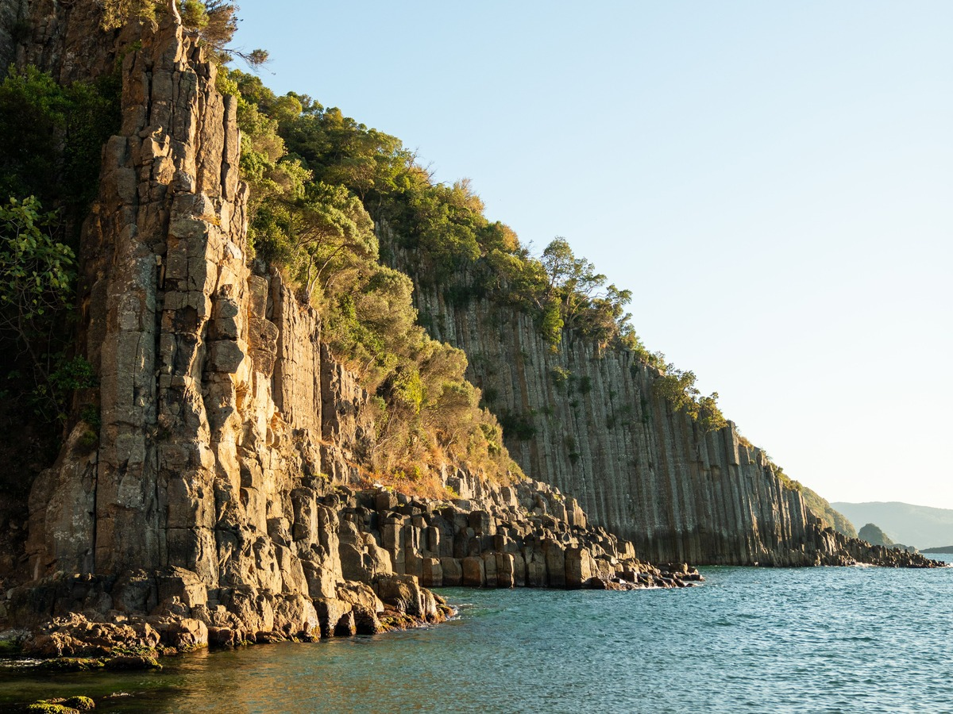
Tojinbo is a stretch of cliff on Fukui’s northern coast, in Sakai City, where roughly a kilometer of sea cliff drops straight into the Sea of Japan. The rock is pyroxene andesite, formed when magma pushed into layers of sedimentary rock around 13 million years ago and cooled into long, roughly hexagonal columns. Wave erosion later exposed what had hardened underground, and the scale of the columns is rare enough that Tojinbo was designated a national Natural Monument in 1935 and later added to a national list of Japan’s hundred best geological sites. Standing at the edge, the columns look almost deliberately stacked, like something built rather than formed.
Most visitors see Tojinbo two ways. Walking the clifftop paths gets you close enough to look straight down the rock face and out across open water. This can feel unsettling for anyone uneasy with heights, and care is needed in wind or rain because the surface is uneven and can be slippery. The alternative is a sightseeing boat that runs along the base of the cliffs for about half an hour, passing individual formations that have their own names, including a slender column locals call Candle Rock and a rock formation near the water that guides point out as a lion sitting with its back to the sea. The cruise also gives a distant look at Oshima Island offshore before turning back. Doing both, when time allows, gives a real sense of how different the cliffs look from above and from below; neither view really substitutes for the other.
At the entrance to the cliffs, a row of shops sells dried seafood, local snacks, and, depending on the season, Echizen crab, the variety Fukui is best known for. It’s a reasonable place to eat before or after the walk rather than somewhere to plan an entire meal around.
The sightseeing boat’s service and boarding conditions depend on the sea, so build some flexibility into your schedule if this is part of a tighter trip. Fares for the cruise aren’t fixed here; check the operator’s website for current pricing and the day’s operating status before heading out.
Recommended time: One to two hours for the cliffs alone; add thirty minutes for the boat.
Official website: Tojinbo
Location: Google Maps
Official website: Tojinbo Sightseeing Boat
Oshima Island
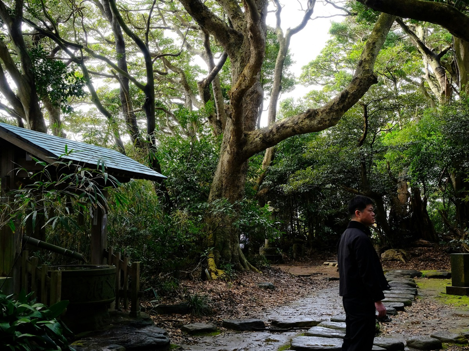
Photo: Unsplash
A 224meter red bridge crosses to Oshima, a small, uninhabited island that works better as an add on to a Tojinbo visit than as a destination in its own right. On foot from Tojinbo, reaching the bridge takes about 40 minutes; by car, it’s a short drive to a parking area near the bridge itself. Dense forest covers most of the island, creating a noticeably different feel from the open cliffs you’ve just left. A walking path of about 1.2 kilometers loops the shoreline in around 40 minutes, passing Ōminato Shrine partway around and a lighthouse near the far point. The volcanic rock here has its own character, set among the trees rather than exposed to the open sea the way Tojinbo’s cliffs are.
There’s no charge to visit the island itself. A local bus also connects the two, though service can thin out or pause entirely outside the main travel season, or for safety reasons at certain times of year. Check the bus company’s website the day before rather than building a plan around it in advance.
Official website: Oshima Island
Location: Google Maps
Travel Tips
The biggest planning mistake with these two areas is treating them as neighbors. They sit in different directions from central Fukui, and reaching each one involves a different combination of transport.So covering both in a single day, especially without a rental car, is more ambitious than a map suggests. Decide which one matters more, or split them across two days if your schedule allows it.
At Mikata Five Lakes, the summit viewpoint isn’t reachable on foot or by bicycle, and regular train service only gets you to the general area, not to the gate itself. A seasonal bus, the Gokoichi Bus, covers the final stretch on the days it runs; outside those days, a rental car or a pre-arranged taxi is the practical option. Check the official website for the current schedule before counting on the bus, and if you’re relying on a taxi, confirm ahead of time that one’s available near your arrival station, especially outside the busiest travel months.
Tojinbo rewards some weather awareness. The cliffs face open ocean, and wind can pick up with little warning, which can affect comfort on the clifftop paths and whether the boat cruise runs that day. Bring an extra layer even on a warm day, since the exposed clifftop tends to run cooler than inland Fukui. If the boat matters to your plans, check the operator’s site the morning you go rather than assuming it’s running.
Local bus routes serve both areas, but schedules can be seasonal, with weekend and holiday only service in some cases and full pauses in others. Treat any bus timetable found while planning from home as a starting point, not a fixed schedule, and reconfirm close to your travel date, particularly outside the spring to autumn season.
If a Kanazawa extension is already part of your trip, a common add on from Kyoto or Osaka, both can be added along that route, although each still requires a side trip from the main rail corridor. That makes it easier to fold into an existing itinerary than to treat it as a separate trip on its own.
One seasonal note applies no matter what else is on the itinerary: Echizen crab, the variety Fukui is known for, is in season through the colder months and shows up heavily around Tojinbo. It’s reason enough to time a visit for winter rather than avoid it.
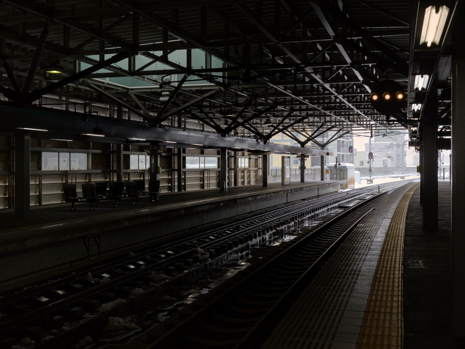
Photo: Pexels
Since March 2024, the Hokuriku Shinkansen has extended to Tsuruga. If you’re coming from Tokyo, get off at Fukui Station for Tojinbo; continue to Tsuruga if Mikata Five Lakes is your destination. From Osaka or Kyoto, the Thunderbird limited express’ last stop is Tsuruga, while travelers from Nagoya can reach Tsuruga on the Shirasagi. From there, transfer as needed for your destination.
For Mikata Five Lakes, travelers arriving at Tsuruga can change to the Obama Line toward Mihama Station. For Tojinbo, travelers arriving from the Kansai or Nagoya side can transfer at Tsuruga to the Hokuriku Shinkansen for Fukui Station. Travelers coming from Tokyo should get off at Fukui Station directly rather than continuing to Tsuruga.
From Mihama Station, the seasonal Gokoichi Bus continues on to the Rainbow Line summit park on the days it operates; outside that schedule, a taxi or a prearranged rental car covers the final stretch. Drivers coming from the Kansai side generally leave the expressway at Tsuruga and continue on the Maizur Wakasa Expressway; the Wakasa Mikata interchange sits about ten kilometers from the summit park’s parking area, roughly a twenty minute drive. Coming from Kanazawa or Nagoya by car, the routing joins the same expressway system at Tsuruga.
Tojinbo connects more directly. From Fukui Station, the Echizen Railway runs to Mikuni Station in around fifty minutes, followed by a local bus to the Tojinbo stop and a short walk from there. By car, the same trip from Fukui Station takes about fortyfive minutes on local roads. That difference in ease is part of why splitting the two areas into separate excursions is practical advice rather than just a cautious one.
Having a local eSIM active is genuinely useful for this stretch of the trip. Neither area is especially hard to reach, but checking a bus schedule, confirming a boat’s operating status, or pulling up a map at an unfamiliar station is far easier with a working data connection than without one.
Summary
If you can only manage one of these two, let the season and your own pace decide. Mikata Five Lakes suits a slower day with time for cycling, a boat ride, or the museum, while Tojinbo is more of a striking few hours, best timed for calm weather and, if possible, late afternoon light. Fitting in both works better as two separate days than one rushed pairing.
Before you go, pull up the official sites for whichever spots made the list. Hours, transport, and boat schedules all shift with the season, and in this case, checking isn’t a formality; it actually changes how the day goes. Neither place is difficult once you’ve arrived. Getting the timing right is most of the work.